Project Etobicoke A
Design -> Tender : August 2023 -> July 2024
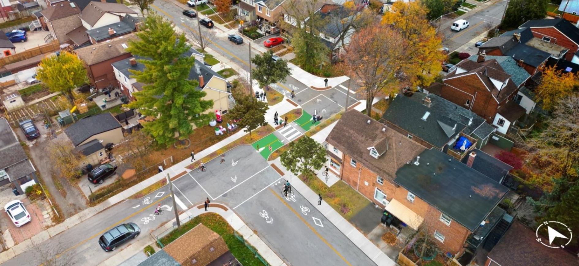
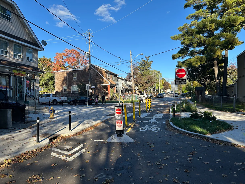
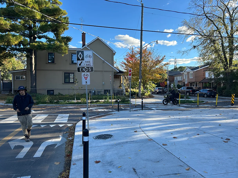
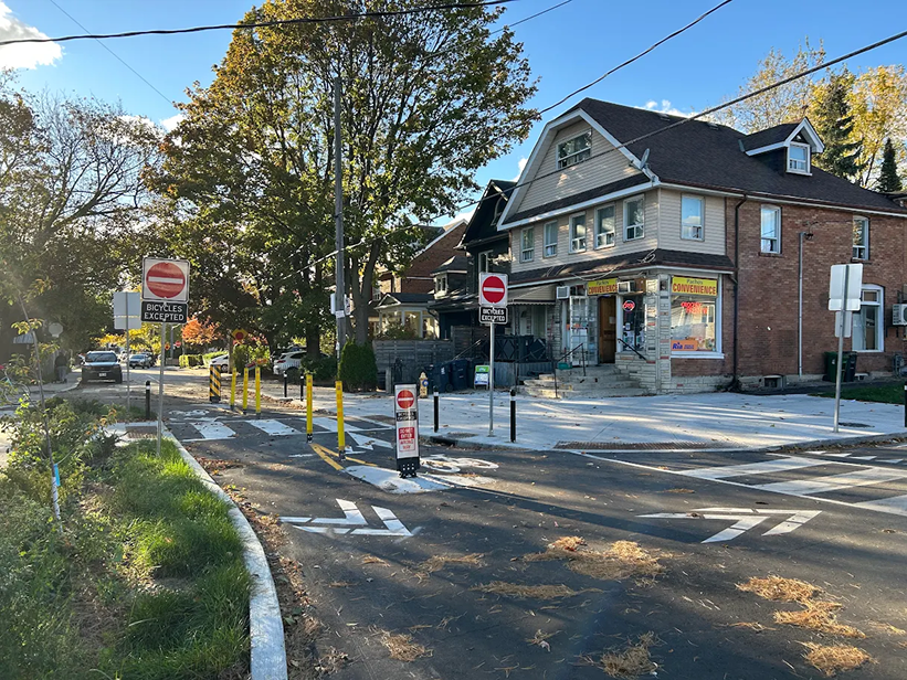
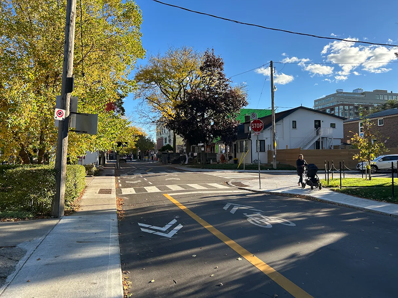
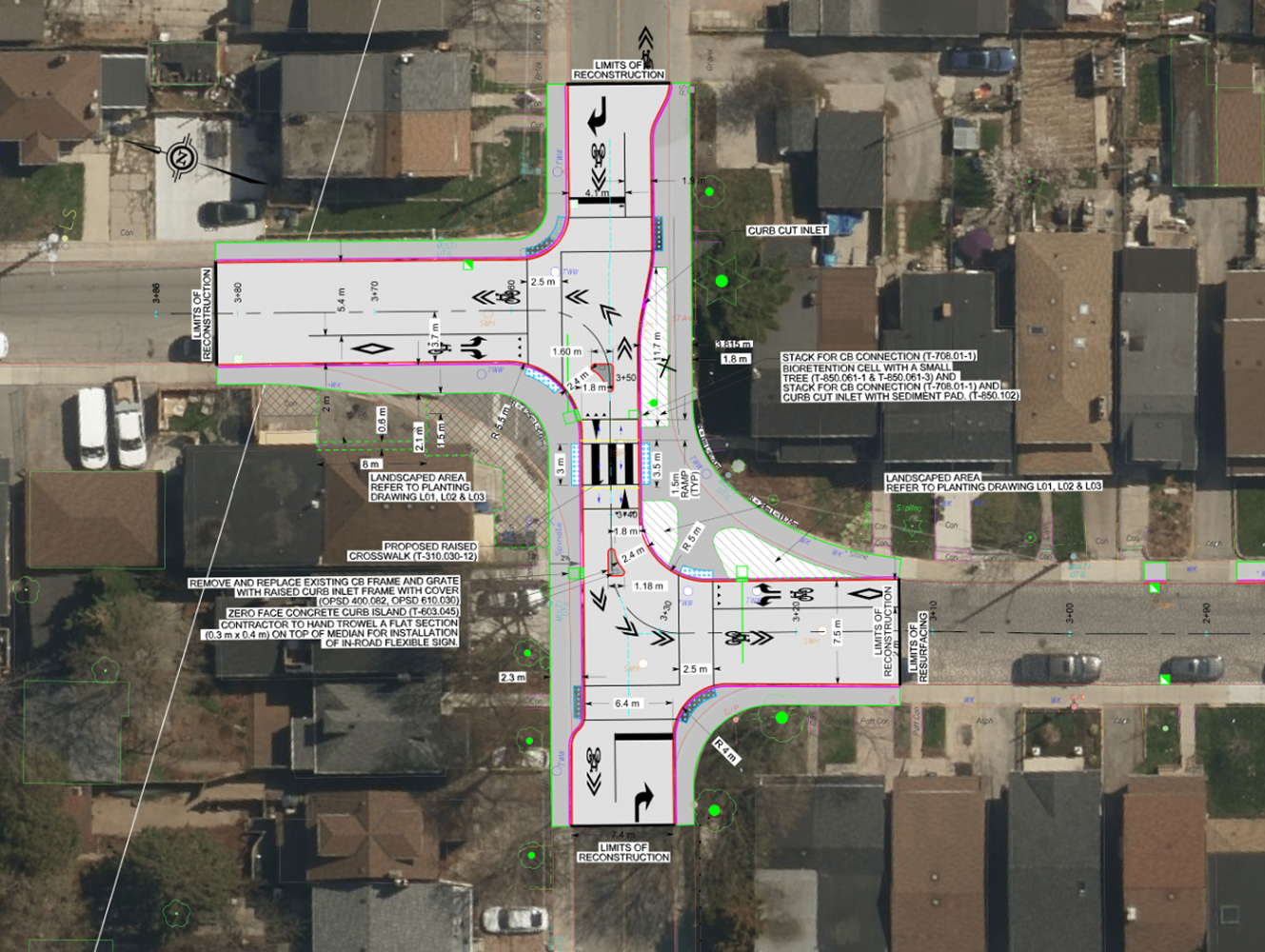
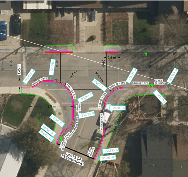
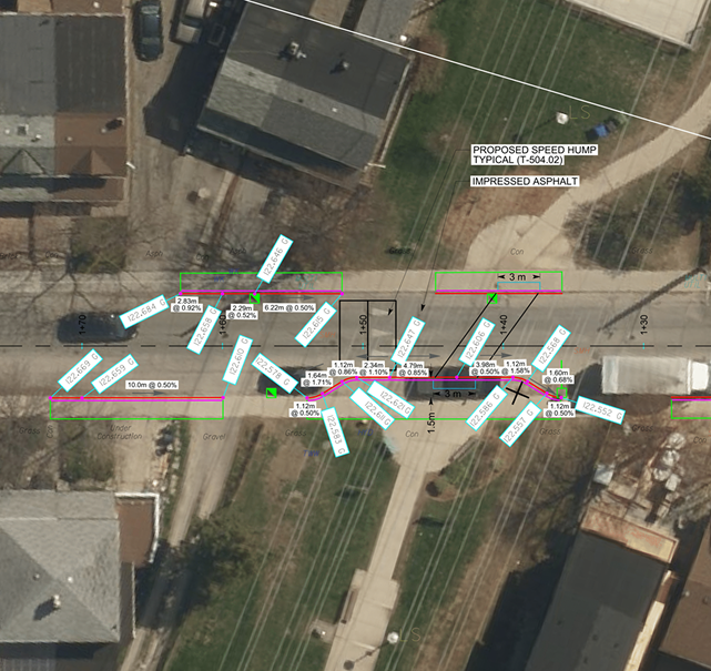
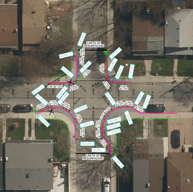
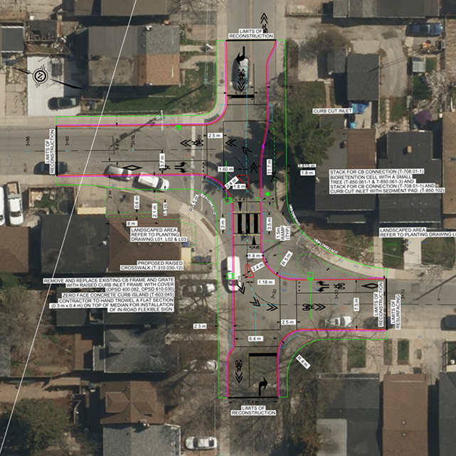
Originally a simple resurfacing with a curb extension, Project Etobicoke A’s scope increased significantly, particularly at the Rockwell intersection. Frequent scope changes near the tender date delayed the delivery process. The project, 335 meters long, expanded to include LRRS, PII, LRRC, raised crosswalks, curb extensions, cycling infrastructure, and vehicle direction changes. We ensured that local residents affected by these changes were informed, while improving safety and traffic flow in the area.
Planning Phase
Before
Transportation Services has requested this project following a notable number of 311 service requests from residents in the project area. These calls expressed growing concerns about road safety, particularly for vulnerable road users such as pedestrians, cyclists, and seniors. In addition to safety concerns, the existing roadway has reached the end of its service life. The pavement exhibits extensive cracking and surface distress, indicating the need for full roadway reconstruction.
Results
Results
Curb extensions at Intersection A, including an added crosswalk on the opposite side of the road, reduced curb radii from 7m to 5m to slow vehicle turning speeds, and modified vertical grades to improve water flow to the catch basin, as the curb extends toward the road crown, where grades are flatter compared to the curb and gutter.
Bumpout at Park A Trail crossing, featuring added impressed asphalt, tactile plates aligned with the concrete crossings instead of perpendicular to each TWSI. Vertical grades were modified to accommodate the upward slope toward the road crown due to curb extensions. A speed hump was added to reduce vehicle speed, and the catch basin was relocated to improve water flow management.
At Intersection B, the curb extension features an asymmetrical crossing due to differing lane widths on Side Street A North and Side Street A South. Vertical grades were modified, and the catch basin was relocated because of the radii reduction. While the catch basin shouldn’t be placed in the middle of a tactile plate, the lowest point falls there, making this an exception for this project.
Intersection C underwent significant modifications to enhance traffic flow and safety. Curb islands were added to prevent vehicle access, as the intersection was closed and vehicle direction altered. To ensure fire truck access, lane widths were verified through vehicle path simulation. A raised curb inlet was installed due to the gas main blocking the catch basin’s relocation, and two additional curb inlets were added for improved stormwater management. The curb radii were widened for more accurate vehicle turning simulation, and a curb cut inlet was paired with a bioretention cell to address stormwater mitigation needs.